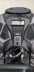
I wanted to update this thread for anyone looking to upgrade to a 700 series in the future. I upgraded from a Skidoo branded Montana 680 to the Montana 700i with the InReach and this is what I found. There are three 700 models and it wasn't immediately obvious what the difference were. Here you go, pretty simple:
700 - No inReach SOS, No Camera
700i - Has inReach SOS, No Camera
750i - Has inReach SOS and Camera
I use GPS Trailmaster maps for Snowmobile and ATV trails in NH, VT, and Maine. The maps uploaded correctly to the GPS but there is a problem with the POI items. The GPSTrailmaster maps install POIs that are trail accessible so you can search for food, gas, hotel, etc and then just follow the turn by turn directions on the trails. On the Montana 680 this works great, but I found a problem with the 700.
The 700 comes with 4-5 default maps that also include their own POI. It's basically setup with maps to use an Automotive GPS if you wanted but the issue here is that every business and service is listed when you search for POIs. For example, I search for gas but now instead of seeing just trail side gas I see every gas station around me with no way of knowing which are on the trail and which are on the road. This is basically a deal breaker for me...
I called Garmin support and they said there is no way to turn POIs off. I tried disabling all the maps but it doesn't disable the POIs. I asked about removing them from the file system and they said you need to remove the maps as the POIs are included into the map image file. They highly recommended that I don't remove these preloaded maps as you can't easily reinstall them. I explained that I'm going to try it because If I can't filter out the snowmobile specific POIs then the GPS is useless and I'll send it back anyway.
So I deleted all the preinstalled maps and just left the Snowmobile map. Now when I search for gas, it only shows gas stations that are accessible based on the Snowmobile trail map which is what I want. It's a shame that you can't just disable maps and POIs together. I would have liked to keep the Automotive map just to get an idea what is in a town but could use my phone for that. This GPS will only be on the Sled or a SXS.